Taking road trips to see interesting things is something that’s as natural to me as breathing. I think a lot of people are probably wired that way; it’s just my definition of “interesting” that differs from most.
[NOTE: All of the photographs in this post are presented as largish thumbnails. You can click each image to enlarge it to the width of your browser window for detailed viewing.]
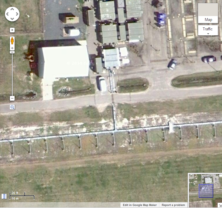
The seeds for this road trip were sown when I discovered an odd-military-looking base on the Virginia/North Carolina border while exploring on Google Maps one day. It seemed to have a lot of interesting features. A big circle of cleared land marked where a huge, 1000-foot-wide direction finding antenna, nicknamed an “elephant cage,” once stood. There were several towers, antennas of various types including several largish dishes, and lots of buildings. Something I thought was a landing strip caught my eye. At 1.6 miles it was certainly long enough to be a runway, but as I zoomed in, I saw pairs of vertical antennas instead! (A very small piece of the array, near its center, is pictured below.) What was this? After some extensive research, I had my answer.
 During the cold war, the government developed and deployed a technology called OTH-B Radar. While most radars operate at microwave frequencies and are restricted to line-of-sight operation, OTH-B could see over the horizon, to a potential range of 3,000 miles, and operated at HF frequencies (2-30 MHz, what some people call “shortwave”).
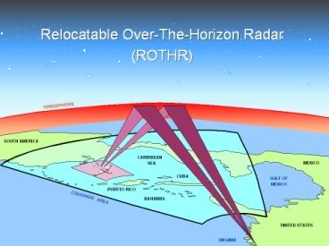
At the height of the cold war, stations in California and Maine searched diligently for incoming bombers using this technology. Antenna structures were huge on a scale that can scarcely be imagined. As the cold war ended, these facilities, now quite long of tooth, were dismantled. (The buildings and fences remain; take a look at the area just north of Moscow, Maine sometime on Google Maps and you’ll see the footprints of three mammoth OTH-B antenna arrays.) Ironically, a new generation of over-the-horizon radar was ready for deployment . Raytheon’s ROTHR (Relocatable Over The Horizon Radar) was all dressed up with nowhere to go. But aside from bombers, there’s another type of aircraft that the government would love to see coming a thousand miles out — drug-smugglers. So the ROTHR system, fresh from testing on Amchitka Island, Alaska, was set up here, trained south, and is still in use today for drug interdiction and homeland security purposes.
 Both the old and new generations work the same way. A transmitter sends out very, very powerful signals in a tight beam which is swept across the area under surveillance. The signals bounce off the ionosphere, a group of layers in the upper atmosphere that are ionized and reflect radio waves. The waves come back down and strike objects in the target area, and return the way they came. A sensitive array of receiving antennas picks up this “backscatter” and it’s sent to specialized computers for analysis. Because over-the-horizon radar essentially looks DOWN on its targets, they’re mixed in with a lot of ground clutter, but moving targets create a doppler shift in the backscatter signal that can be detected and processed to enhance the target.
I thought it would be a lot of fun to drive up and see if I could get close enough to this sprawling base to get a few pictures of the antenna array. It seemed plausible that there might be gaps in the trees or vantage points along the roads, so I set out with my camera to see what I could find.
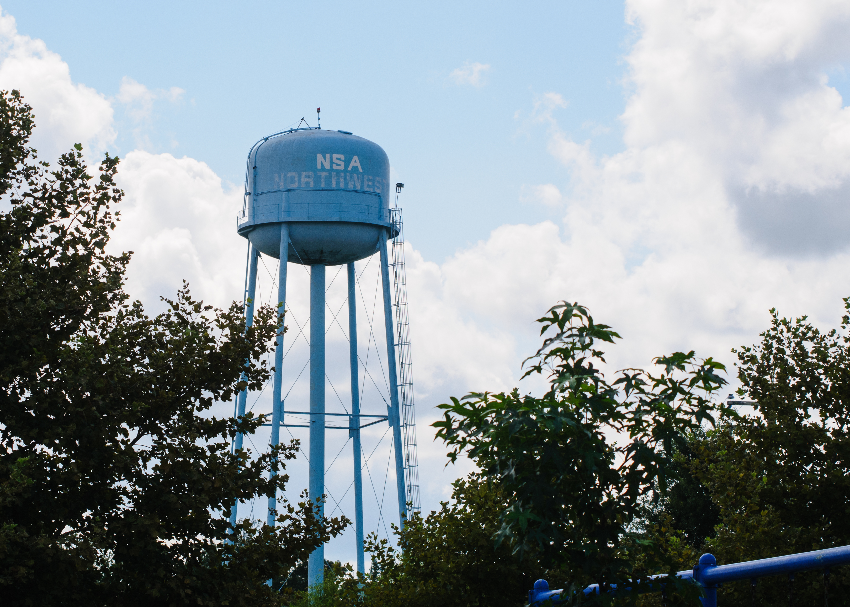 As it turns out, one does not simply take a picture of anything inside this base. I drove all the way around the base, exploring every road, every footpath, and every gap in the trees. That last part was easy, because there weren’t any gaps. In fact, despite dogged determination, I managed to see not a single hint that there was any major hardware in the area. To the casual observer, the base might as well have been a supply depot. The only hint that I was in the right place at all was a water tower painted with the words “NSA NORTHWEST.” (The sign at the gate clarified that NSA stood for Naval Security Activity, not National Security Agency.) I saw some very nifty base housing, a base medical complex, and a lot of very stern signs warning that proceeding beyond them cause very nasty things to happen to me.
Of course, this site is only the receiving array. The incredibly high power of these radars requires the transmit site and receive site to be separated, probably so that the multi-megawatt pulses from the transmitter don’t fry the receivers. A short talk with a local before I left town seemed to indicate that the transmitter site, which is not on a military base, might be somewhat less impenetrable.
 It was about 100 miles away, farther from home, and I hesitated until I realized that the most wonderful barbecue joint on the planet was right on the way there. Cue the sound of a Prius peeling rubber.
Pierce’s is worth a minor digression here. Located just west of Williamsburg along I-64, and in business for more than 40 years, it is a Virginia landmark. When I posted on Facebook that I was at Pierce’s, my high school physics teacher commented that he can’t make a trip east without stopping there on the way, and again on the way back. When I lived in Charlottesville, my modus operandi was exactly the same. The meat is cooked in a pit out back, the old fashioned way, and Doc Pierce’s barbecue sauce may be the most perfect combination of spices ever to grace a piece of brisket. Needless to say, lunch was the highlight of the trip — so far.
Off I went in search of the transmitter site, and a couple of dozen back road miles later, I began to see signs that I was in the right area — literally.

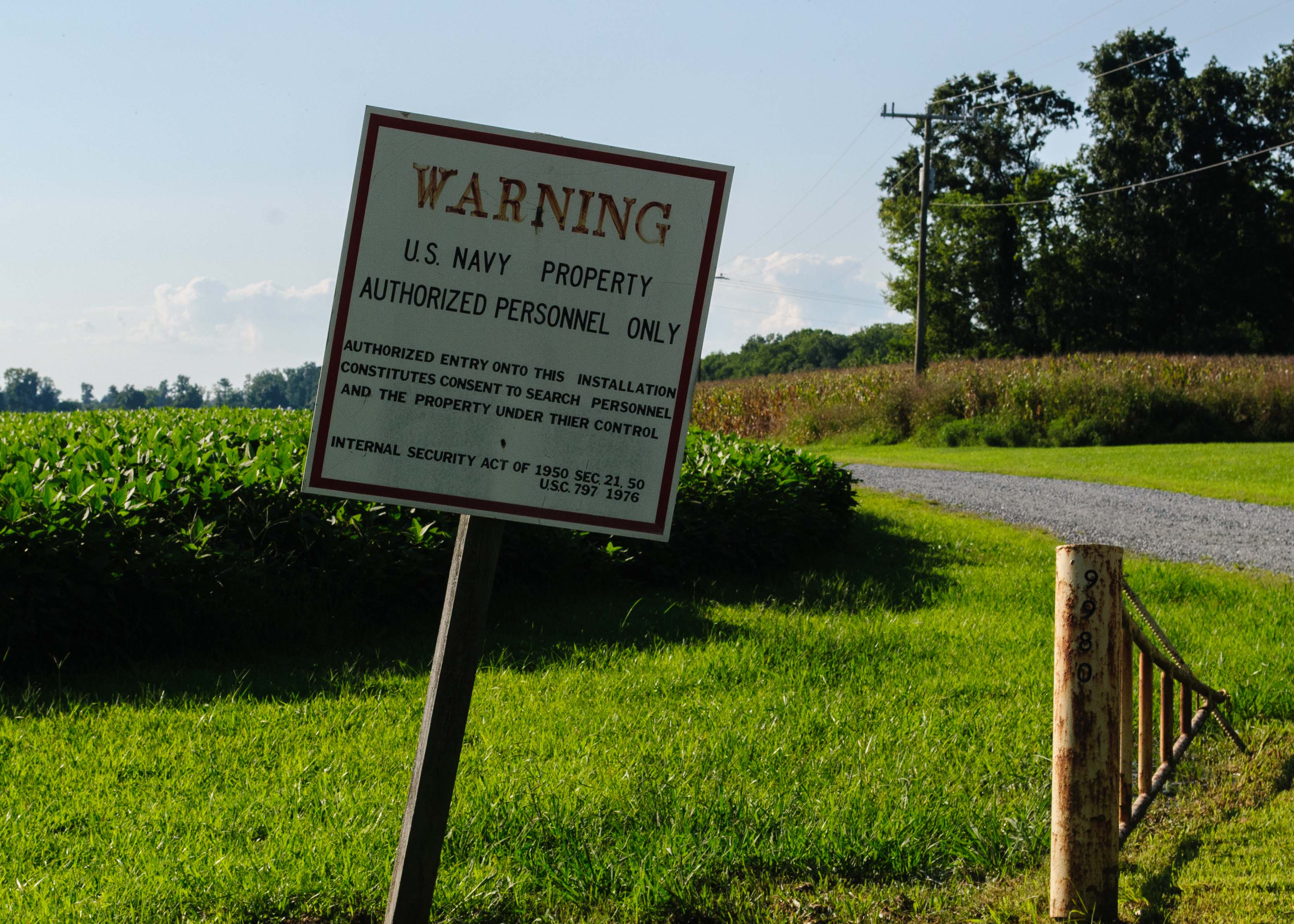
At the end of a gravel road lay my quarry, and it was quite a sight. There were a total of 36 towers that I could immediately see, several shorter structures, and miles of antenna and guy wire. I could get no closer than a hundred yards or so, but considering the amount of RF power that drives this array, I was happy to keep my distance. As it was, my digital camera and my car radio were having difficulties, since I was in front of the antennas. I was able to find some sweet spots where my camera wasn’t being dazzled in order to take the following photographs.
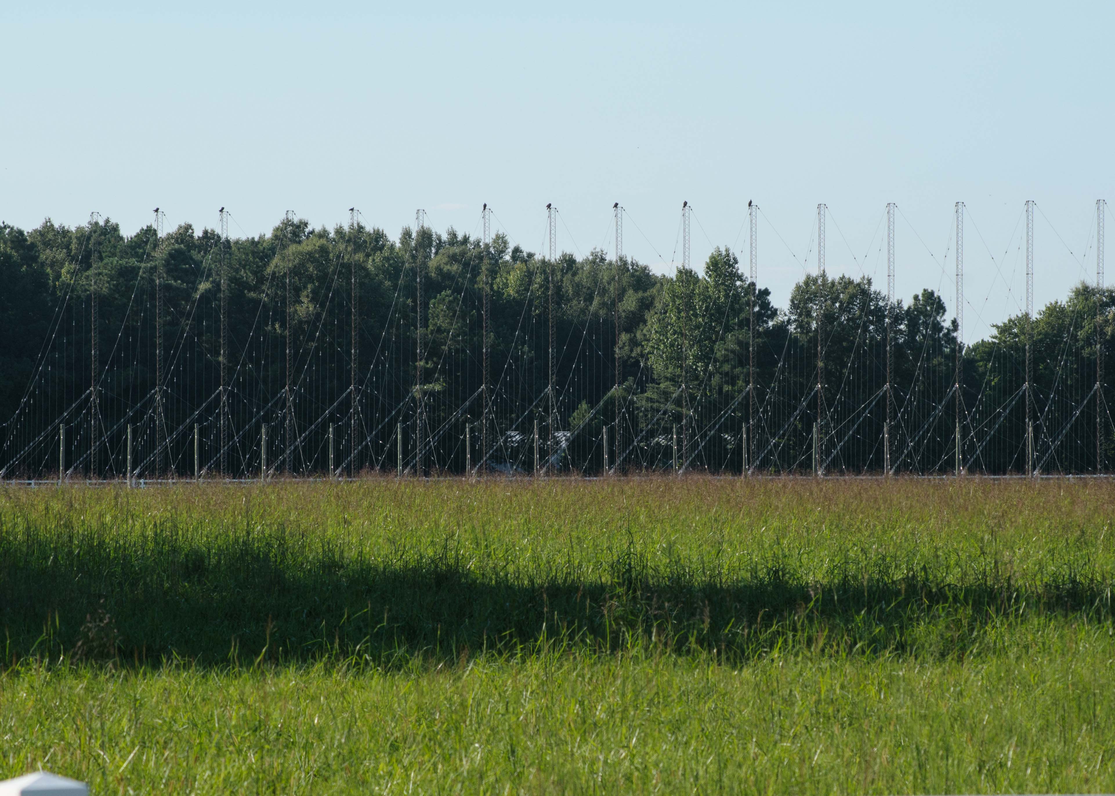
Here we see the high-band transmitting array. There are sixteen towers, all of which are grounded; they’re merely support structures. The actual antenna consists of numerous dipole pairs strung between the tower tops and the low poles in front of them. Each section of the antenna has several dipole pairs. By feeding the antennas with signals at varying phases, the signal is formed into a tight beam that can be scanned vertically and through a 60 degree azimuth range.
At the time the photo was taken, I believe that the low-band array was in use, which would explain the willingness of those crows to perch on top of the towers. Also I seemed to have less RFI trouble when I was in front of this high band array.
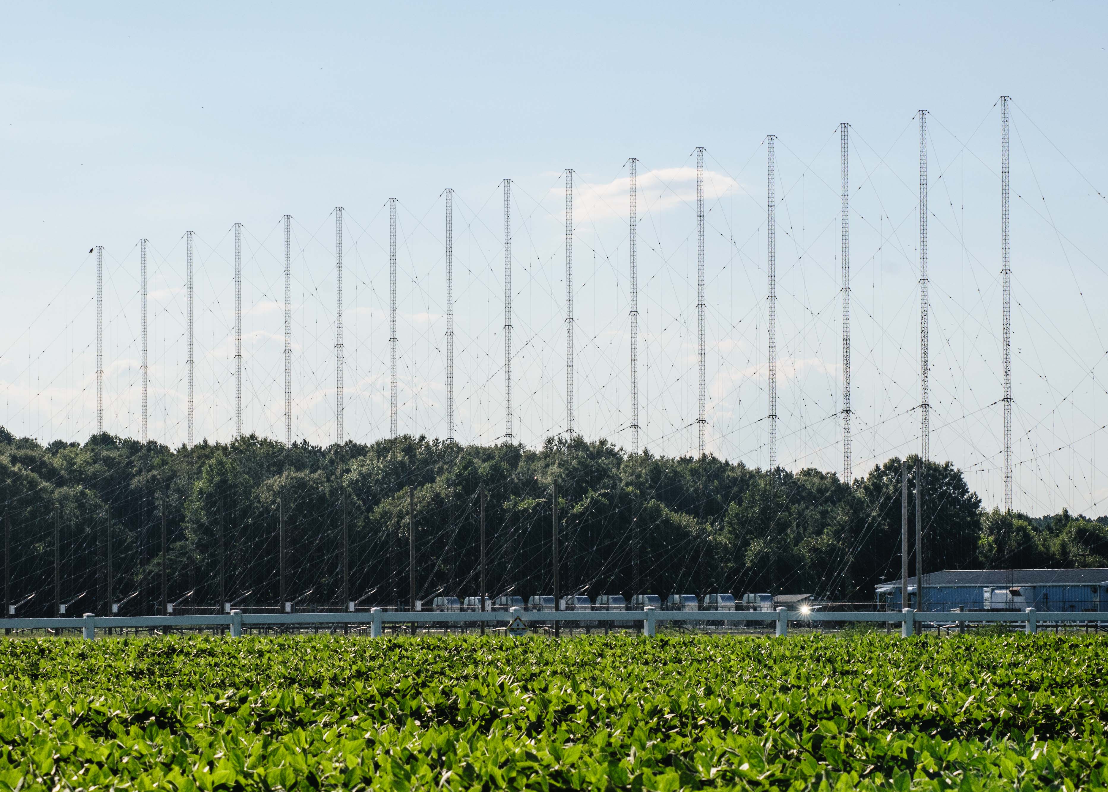 This is the low-band transmitting array. These towers are 60 meters tall due to the longer wavelengths at these low frequencies. Other than that, the construction is much the same with 16 supporting towers and around 200 dipole pairs for steering the beam. The blue building to the right is the transmitter building. The vegetation in the foreground is a civilian farmer’s bean field between the road and the perimeter fence. Security was pretty low here — had I wanted to, I could have easily hopped across the low, plastic rail fence. The gate, which you saw earlier behind the canted sign, was wide open. The site was definitely manned, though; I spotted a HMMWV and two white vans parked near the transmitter building.

I noticed some extra towers that didn’t seem to be part of the array, and wondered about them. It turns out that they’re “sounders.”
In order to use an over the horizon radar to locate something, you’ve got to know one important bit of data. HOW HIGH is the ionospheric layer that your pulses are bouncing off of? That changes on an hourly basis, so there has to be a way to keep track of the height so that the range calculations will be correct. So there are two “sounders.” The vertical sounder (supported by those tilted tower sections in the background) sends waves straight up, and analyzes them to determine how high the layer is that reflected them. The backscatter sounder (supported by the two 60-meter towers in the foreground) sends a wide beam over the radar’s entire coverage area, and analyzes the backscatter to determine the quality of the ionospheric reflections overall.
The vertical sounder threw me at first look, because it appeared something had fallen down.
 Here’s a closer look at the transmitter building. As you can see, it’s a run-of-the-mill aluminum and steel building, although the presence of the backup generator, the heavy-duty air handler and air conditioning systems, and the hefty incoming power transformer indicate that there’s something inside that draws a lot of power and makes a lot of heat. You can see some of the RF transmission lines running on elevated posts near ground level. You also get a much better idea of the complexity of this nest of wires and insulators from this shot. At the far left edge of the picture, you see something that’s still a mystery to me. (How dare the Navy not put every technical detail of their super-secret radar on the Internet?)
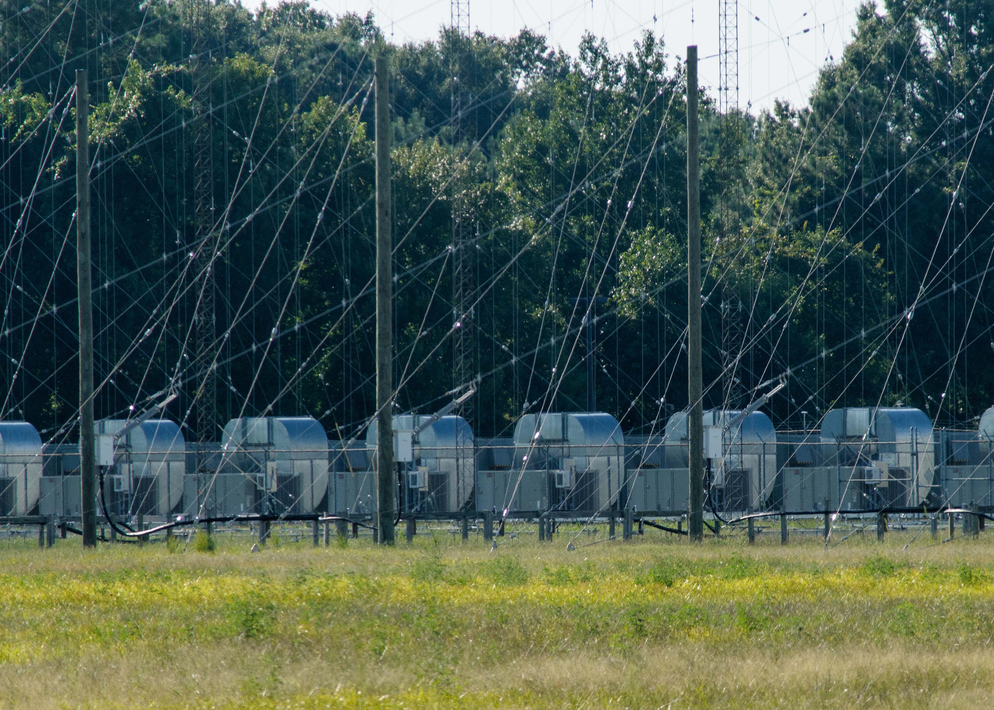 There are ten of these, all situated behind a chain-link fence at the back of the low-band array. Ten seems like a very strange number — each array has 16 sections, so I would have expected either eight or sixteen of these units. Are they some sort of antenna phasing devices? I cannot begin to hazard a guess, because I’ve never seen anything shaped quite like that before. The silver, reflective part looks almost like air conditioning ductwork!
You can also conclusively see in this photograph that the towers are grounded — they have non-tapered bases, and there are no base insulators to be seen. They are apparently bolted to their concrete piers.
 Here’s another view, from a viewpoint farther east. Here you see the high band array, from an angle that better shows the way it’s constructed. As you can see, there’s a lot of antenna wire here. At the right edge of the picture, you’re seeing the first six low poles of the low-band array, with the 60-meter towers just out of frame.
This site is on the shore of a river, and ground conductivity must be excellent. The towers are arrayed along a line from west to east, with the antennas facing due south. From west to east are the high-band array, the low-band array, and the sounders. The river is so close by, one wonders if the site ever floods and how that’s handled.
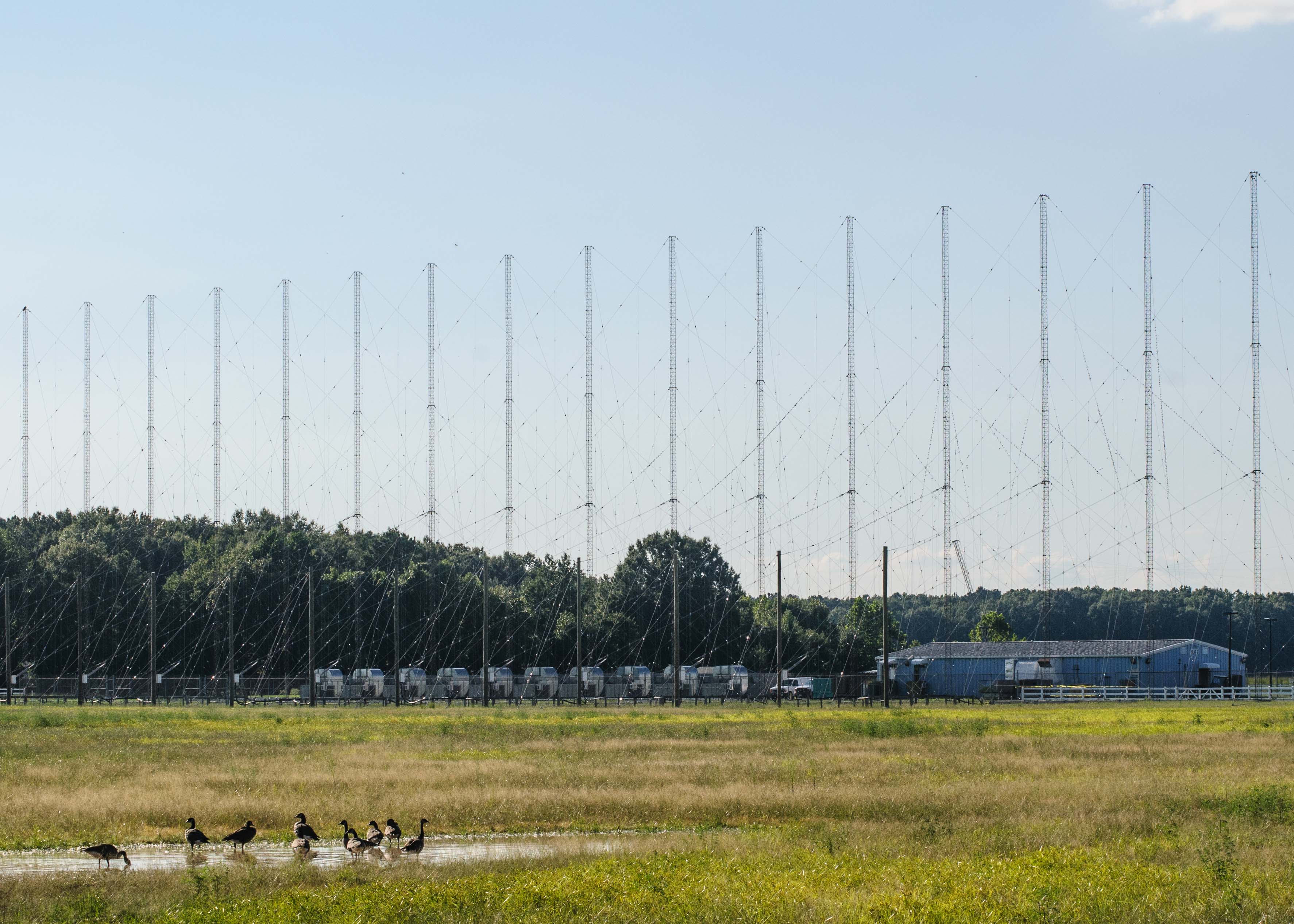
Here’s a wide look at the low-band array. The field in front of these antennas is very wide and very flat. Birds seem to love the area.
The space in front of the antennas would need to be flat to avoid interfering with the signals, but I also saw signs that the entire field may have buried beneath it a copper ground screen. Perhaps this is somehow important to the antenna’s radiation pattern.
All in all this was a fascinating site, and I’m glad I took the time to come see it. Of course, like most such visits, this one raised questions as well as providing some nice photographs. What ARE those weird units?
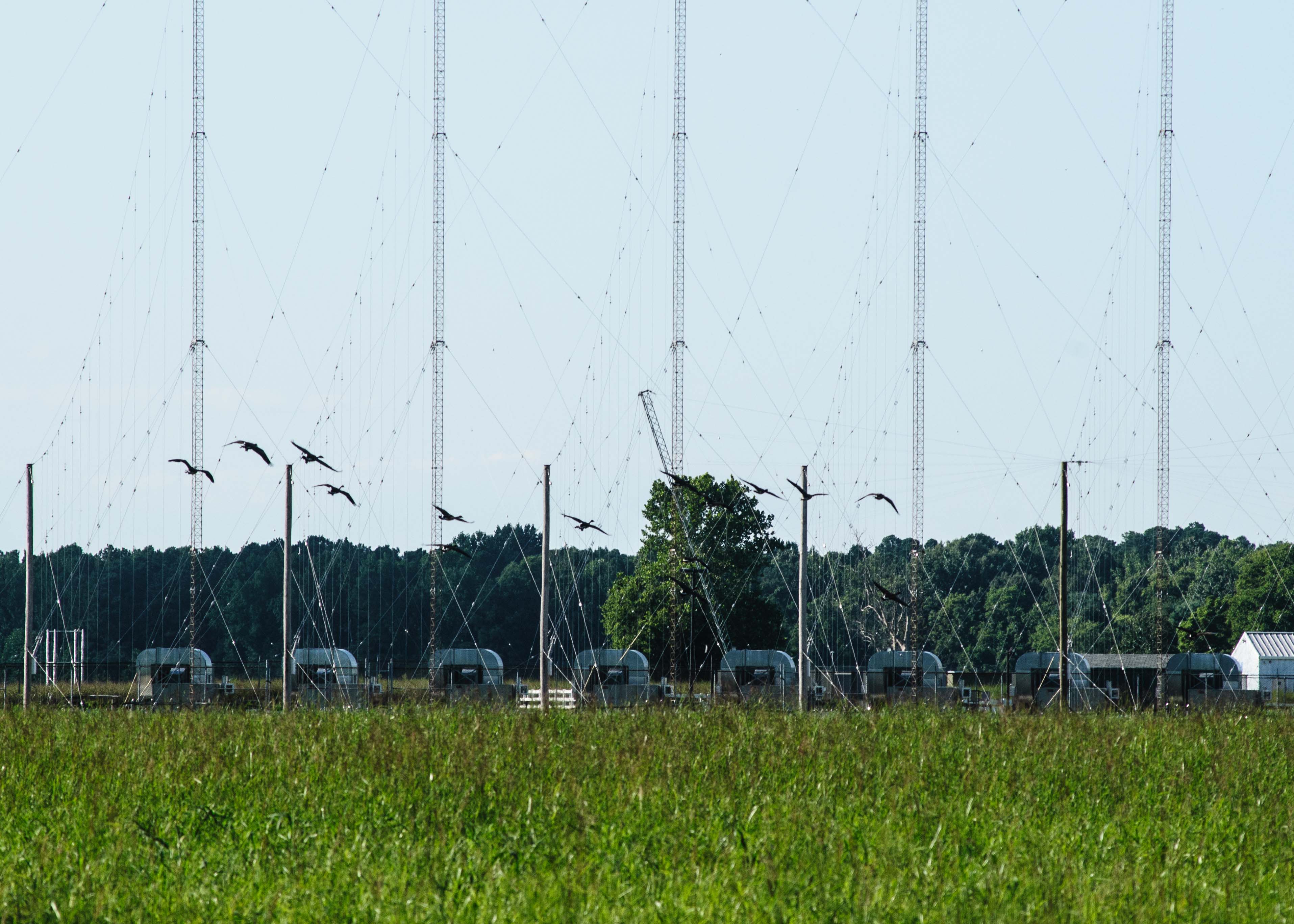
After nearly an hour of snapping pictures and pondering, I noticed a man in a nondescript car stop, write down my car’s license plate number, then drive away. I took that as my cue, and like these lovely birds, I decided it was time to fly home. I got to the house plenty late and mighty tired, but I think it was worth it.
Permalink
Back before college I worked painting houses – one of those houses was a hair past the gravel road for this facility – though at the time I had no idea what it was. Later in life I looked at aerial imagery of the area for kicks and discovered the weird towers and clearing. Did some googling and came to your site – thanks for the detailed pictures and info!
Permalink
Those “weird units” are the transmission power controllers. Keep in mind that the output power of the array is dynamically adjusted based on a number of factors, including the distance of the ionosphere at any given time. So the output power of the antennas needs to be increased or decreased accordingly.
Permalink
I worked at the receiver site off Battlefield Rd in VA. I was the tech for the command that sometimes took the ‘flying-clock’ to the X-mitter site for phase checking. (GPS was not used at that time, 1987) I also had to inspect the ‘grounding’ grid under selected antennas for proper connections. (i.e. that grid looked like a cargo net only made of 00 multi-strand wires connected at the junctions) Thanks for the memories. Mike C.